


Offline Maps - custom area caching and real-time label tracking app for iPhone and iPad
Developer: Sergey Vdovenko
First release : 17 Dec 2014
App size: 10.15 Mb
The most complete alternative offline maps package in AppStore.
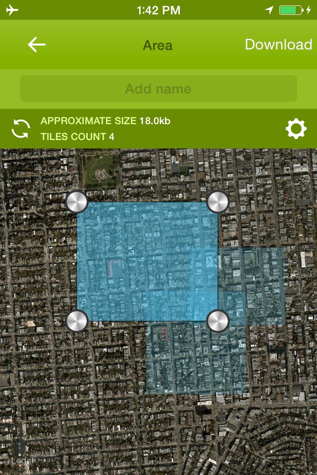
If youre going someplace where mobile data is expensive or you wont have an Internet connection, you can save a map to your device and use it when youre offline. Weve collected all available map sources and combined them into one easy to use application. Select your favorite map provider, select zoom layers and mark the area you would like to be stored.
The app is great for hunting, fishing, hiking and all kind of outdoor activities. USGS topo maps for US also available. For GPS track recording please refer to Track Kit and Track Kit Pro available in AppStore.
[MAPS]
16 downloadable map sources from total of 27 providers.
Worldwide coverage
You can rotate the map
[GPS and BATTERY USAGE]
Always know where you are with GPS
Quickly turn GPS ON and OFF using antenna icon in main menu to save your battery life.
Auto-follow mode. When enabled, the map automatically orients itself to the direction you are moving.
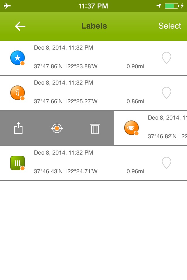
[LABELS TRACKING]
Add labels with long tap or by special button in menu
Add images and notes to a label
175 label icons
Export labels as GPX/KML/KMZ
Real-time tracking to selected labels
[MEASURE]
Measure route distance, radius and angles on the map
[IMPORTANT NOTES]
Continues usage of GPS can dramatically decrease battery life. You can turn GPS off in application menu.
For more cool features please refer to Track Kit Pro.
If you like the app, please write us a review on iTunes. Your support would greatly help us make the application even better!
If you know more map sources please write us: [email protected]